Safety
Safe crossings and pathways, lighting, flood mitigation, shared spaces
In September 2020, Council adopted the Gardiners Creek (KooyongKoot) Masterplan that sets the vision for the revitalisation of the Gardiners Creek corridor through revegetation and biodiversity improvements, water sensitive urban design, shared path upgrades and enhancing opportunities for active and passive recreation.
The Masterplan area extends 8.7km from where Gardiners Creek meets the Yarra River in Kooyong through to Warrigal Road in Malvern East and, as well as the creek itself, takes in significant passive and active recreation spaces such as Sir Zelman Cowen Park and sportsgrounds, Tooronga Park, Gardiner Park, Glenburn Bend Park, TH King Oval, Glen Iris Wetlands, Glen Iris Park, East Malvern Tennis Club, and Darling Park.
Due to the scale and diverse use of spaces within the Gardiners Creek master plan area site specific concepts designs were developed based on geographic zones:
Zone 1 – Monash Freeway
Zone 2 – Sir Zelman Cowen Park
Zone 3 – Tooronga Park
Zone 4 – Tooronga Road to Burke Road
Zone 5 – Burke Road to Elm Road
Zone 6 – Glenburn Bend Park
Zone 7 – TH King and Glen Iris wetlands
Zone 8 – Darling Park (Dunlop Street to Winton Road)
Since adopting the Gardiners Creek master plan, Council secured a parcel of land from the Malvern East RSL that has been developed into a temporary park.
The land is on Basil Street between the RSL and the creek, and it makes sense to include it in the larger long-term Gardiners Creek project. To do so, with your help we’ll develop a master plan for the future of the Basil Street land that will complement other works planned under the Gardiners Creek Zone 8 implementation.
Delivering the projects within the Gardiners Creek master plan will happen progressively over several years.
We currently have funding for:
Zone 2B – Talbot Crescent – construction expected 2025-2026.
Gardiners Creek Trail (shared user path) – fully funded and to be delivered in stages, starting with the section between Dunlop Street and Winton Road in 2024/25. The plan will include:
Zones currently without funding will be programmed as soon as funding becomes available.
The Gardiners Creek (Kooyongkoot) Masterplan was endorsed in 2020. In 2024, community consultation was held to help shape the concept designs before moving into detailed design.
Both the Masterplan and Implementation documents present spatial information and concepts through a series of ‘zones’ (numbered 1 to 8 from west to east). The 2024 consultation comprised the following lines of enquiry:
*high-level engagement is online and on-site feedback only – no targeted surveys undertaken to date.
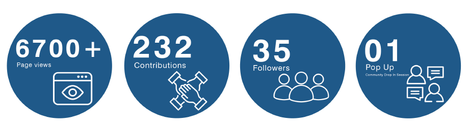
Consultation was promoted through more than 600 letter-drop brochures, 20 on-site posters, social media posts, e-newsletters, and online content.
Feedback was collected via the online interactive website, an online and paper-copy survey, direct emails and phone calls, and a drop-in session at Tooronga Park.
Safe crossings and pathways, lighting, flood mitigation, shared spaces
Signage and art celebrating ecological and cultural stories
Accessible amenities such as toilets, fitness and play areas, dog-off-leash spaces
Native planting, shade, clean-up efforts to improve and create habitat
Improved access, but safety concerns for cyclists and pedestrians noted
For the fully surveyed zones, the following feedback was received:
We want to know your thoughts on concept designs we’ve developed as the first step to implementing the Gardiners Creek master plan. What we hear now will help us deliver improvements to reinvigorate and enhance this important waterway and community recreation zone.
Please click on the relevant zone to view concept documentation and to provide written feedback. Interactive surveys are also available for the following zones - Zone 2(b) Talbot Crescent and Zone 3 - Tooronga Park. These surveys can also be accessed via the links below.
Please note that each of the zones is at a different stage of design resolution. For example Zone 1 is primarily an advocacy package, whereas Zone 3 concept has been developed with an intent to shortly progress to detailed design.
Feedback is welcomed on as many of the zones as you choose – be it specific feedback on your local reserve or a vested interest in the broader health of the creek. All feedback is welcomed.
Zone 1 – Monash Freeway
Zone 2 – Sir Zelman Cowen Park
Zone 3 – Tooronga Park
Zone 4 – Tooronga Road to Burke Road
Zone 5 – Burke Road to Elm Road
Zone 6 – Glenburn Bend Park
Zone 7 – TH King and Glen Iris wetlands
We’ve prepared concept designs for the eight zones that span the master plan corridor. Travel along the map from left to right (west to east) to view the zones and the aspirations for each.
Key:
![]() Zones with a green text bubble icon do not currently have funding. We invite you to have your say.
Zones with a green text bubble icon do not currently have funding. We invite you to have your say.
![]() Zones with a blue document icon currently have funding. Formal feedback is now open.
Zones with a blue document icon currently have funding. Formal feedback is now open.
![]() This refers to the Gardiners Creek Trail (shared user path). We invite you to have your say.
This refers to the Gardiners Creek Trail (shared user path). We invite you to have your say.
Click on the icon to find out more information and provide feedback

The personal information requested in this survey is being collected by Council for the purpose of community consultation.
To find out how your personal information will be used by Council please visit the privacy policy page.
Council has prepared a draft Transport Strategy and three Action Plans covering road safety, sustainable transport and parking. Share your feedback by 16 August 2026.
Ardrie Park playground in Malvern East is being renewed. Tell us what you love about the space and what you'd like to see in the new design by Monday 3 August 2026.
Council is reviewing its hard waste collection service. Share your feedback on what you need and what would make it work better for you. Have your say by 12 October 2026.
We speak your language. Select your preferred language, by using the drop-down arrow next to 'English', on the top right-hand-side on this page.
Translated information about Council services is available by clicking on your language below.
Mandarin – 普通话 9280 0730
Cantonese - 廣東話 9280 0731
Greek – Ellīniká 9280 0732
Italian – Italiano 9280 0733
Polish – Polski 9280 0734
Russian – Русский 9280 0735
Indonesian – Bahasa Indonesia 9280 0737
Vietnamese – Tiếng Việt 9280 0748
Have questions or want to learn more about a project, contact us below:
| Phone | 8290 1333 |
|---|---|
| council@stonnington.vic.gov.au | |
| Website | www.stonnington.vic.gov.au |
| In writing | PO Box 58 Malvern Vic 3144 |


